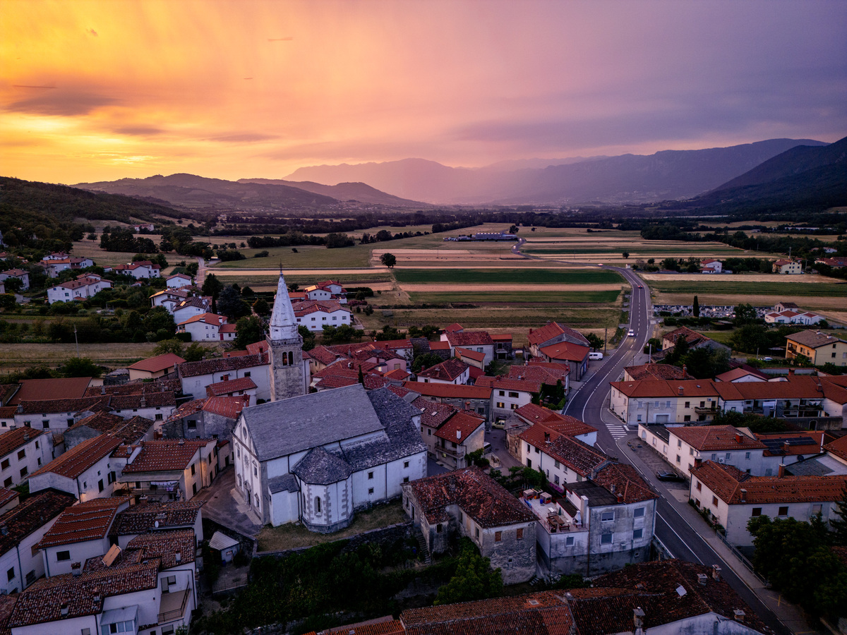
Cycling Route: Vipava – Podnanos
The Vipava–Podnanos cycling route is 10.4 km long. It begins at Lanthieri Mansion in Vipava and ends in Podnanos near the Zdravljica house.
This cycling route, which runs from Vipava through the villages of Slap, Lože, Manče, and Podraga and ends in Podnanos, extends the existing route that follows the Vipava River from its source to the Slovenian–Italian border. In Vipava, the route follows a main road, with some sections on dedicated cycling paths. It then continues along less busy rural roads through the above-mentioned villages. These countryside roads lead cyclists through vineyards and orchards, offering a pleasant experience. The route is also suitable for families.
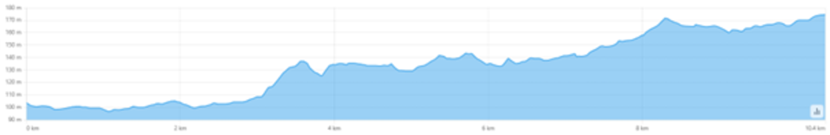
The highest elevation is 175 m above sea level at the endpoint in Podnanos, while the lowest is 97 m above sea level in Vipava. The total ascent is 117 m and the descent is 46 m. The route is not demanding and is suitable for inexperienced cyclists.
The cycling route is marked with signposts for cyclists. The new route extends the existing path along the Vipava River from its source to the Slovenian–Italian border.
Cycling Route: Miren – Confluence of the Soča and Vipava Rivers
The marked cycling route from the settlement of Miren to the confluence of the Soča and Vipava rivers in the Italian settlement of Savogna d’Isonzo is an extension of the existing Vipava River cycling route, this time on the opposite side. The route connects the Municipality of Savogna d’Isonzo with the Municipality of Vipava.
The Miren–Soča–Vipava confluence cycling route is 5.8 km long. It starts in Miren and continues for 800 meters to the state border with Italy. From there, the route continues entirely within Italy. It passes through the villages of Rupa, Peci (Peč), and Savogna d’Isonzo, the center of the municipality, all the way to the confluence of the Soča and Vipava rivers (Špik). Most of the route runs along a local road, allowing cyclists to peacefully explore the surrounding villages.
From the center of Savogna d’Isonzo, the route continues along a well-maintained gravel path to a location beneath the Villesse–Gorizia motorway. From there, the route becomes even more scenic as it continues through the forest. After about 800 meters through the forest, you reach the destination called Špik, where you can rest and enjoy the beauty of the confluence of the Soča and Vipava rivers. There are benches and reading corners with books available.
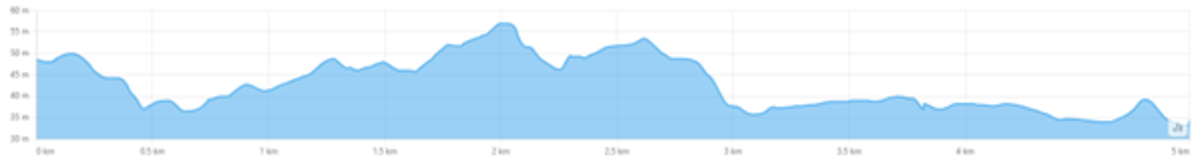
The highest elevation is 57 m above sea level, while the lowest is 25 m at the river confluence. The total ascent is 31 m and the descent is 55 m. The route is not demanding and is suitable for inexperienced cyclists.
The cycling route is marked with unified signposts for cyclists.
Both cycling routes were developed as part of the cross-border BEroots project (Between Rivers and Lagoons: Artistic Paths), implemented within the Interreg VI-A Italy–Slovenia Programme.